Tree Species Ecological Affinity Maps for New Brunswick
Version 1 (Feb 2019)
Download
Canadian Woodlands Forum (CWF) Presentation - Oct 2019
Species Map Images and Accuracy Statistics
Species Raster layers (20 m; GeoTIFF; ~25-80 MB each):
Hardwoods: Sugar Maple | Yellow Birch | American Beech | Poplar spp. | Red Maple | White Birch |
Softwoods: Red Spruce | White Spruce | Black Spruce | Balsam Fir | Jack Pine | Eastern White Pine | Eastern Hemlock | Eastern White Cedar | Tamarack (Larch)
You will need to superimpose non-productive land features and semi-productive bogs on these maps. The species models are not applicable in areas without trees and in marginal forest-land.

What are these Species Affinity Maps telling me?
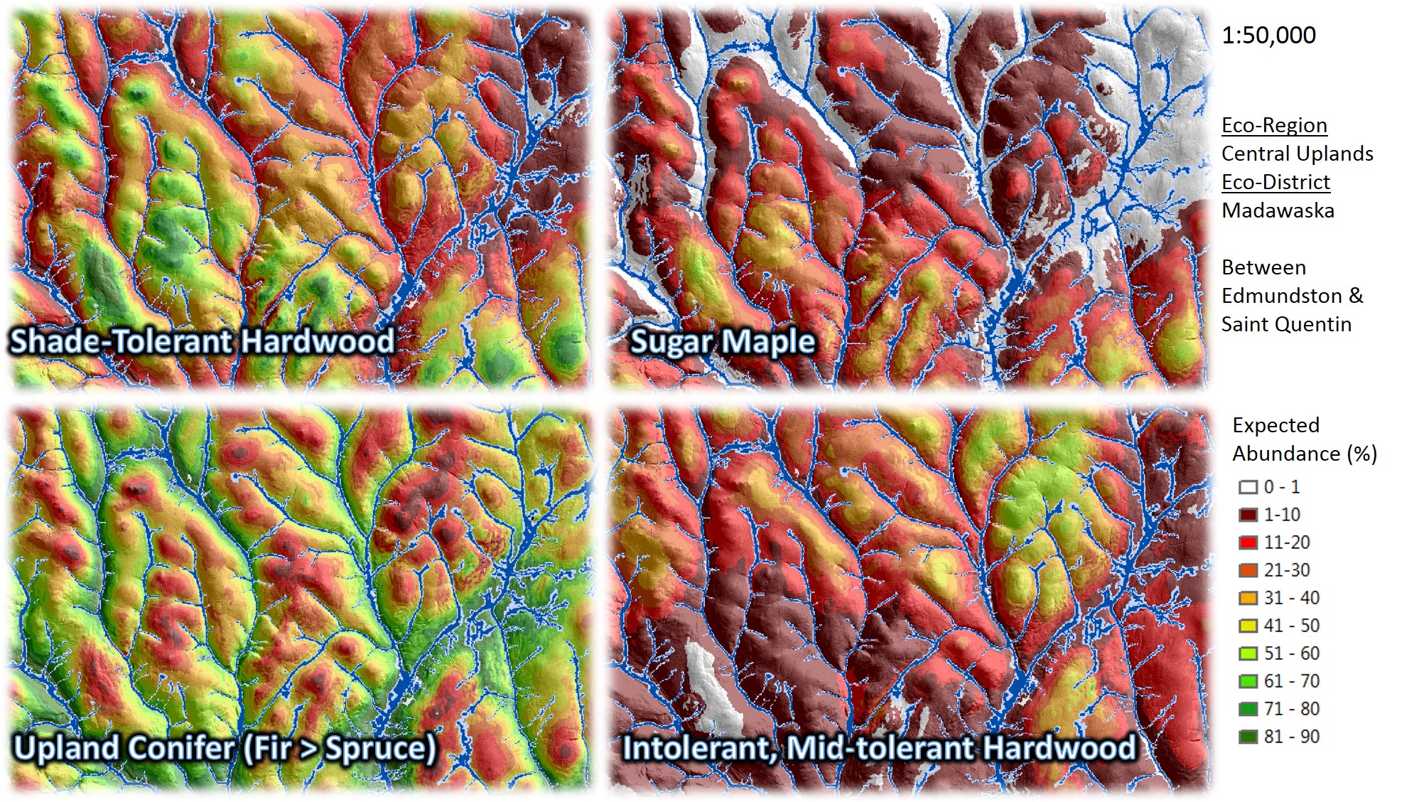
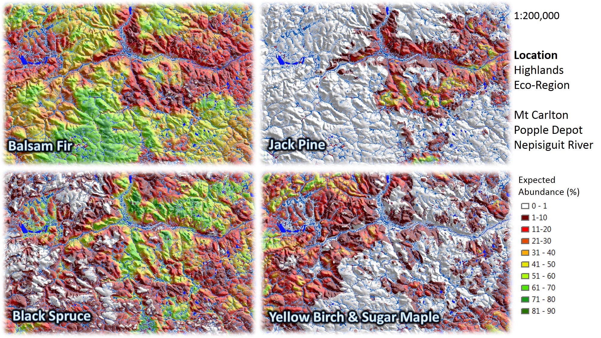
Ecological relative abundance (affinity) of tree species in New Brunswick on any given topographical position, based on provincial ground surveys and photo-interpretation of immature-old stands in that area.
The CWF presentation link above provides more details on methods; or, contact Dr. Chris Hennigar at FORUS Research for the latest information on this work.
Why might they be useful to me?
These maps may allow you to:
- Identify regeneration management zones and best practice guides to promote or reduce certain species in these zones.
- Improve accuracy of stand succession predictions following harvest in NB.
- Spatially map sources and barriers to species migration under climate change.
- Refine ecological land classification and site-productivity prediction.
- Provide contextual information for remotely-sensed species classification predictions.
- Assist with land conservation planning.
How reliable are they?
For understanding where species have naturally regenerated in NB and where they tend to compete well, these maps are useful. They are not useful for mapping current species distributions; for that, see the NB provincial forest inventory shapefile on GeoNB.
For any given location point, these maps explained about 20-50% of species variability in unmanaged immature-old forest established before 1980; see Accuracy Statistics pdf link above. If accuracy was to be accessed more broadly with species relative abundance averaged over all stands sitting on similar topographical positions within each eco-district, we would expect accuracy to be quite a bit higher. This has not been assessed, but is probably a better indicator of the ecological relative abundance of a species on a particular eco-site we have observed.
Species with strong ecological site preferences (e.g., sugar maple, black spruce) seemed to be mapped at higher accuracy
compared to generalists (e.g., red maple, white birch), rare species (e.g., tamarack),
or common but relatively dispersed species that are present in small amounts on many sites (e.g., white pine).

Future work
As availability of LIDAR derived DEMs, better digital soil maps, and remote sensing information improves over the next few years, we hope to revisit this work. Currently, species were mapped locally to elevation, depth-to-water, and slope layers derived from SRTM data.
We would also like to try to prorate all of these species mapped % values to add up to 100% and then map ecological affinity of species composition types in a single raster layer. Users are encouraged to try this themselves; we would love to see your results. Keep in mind that there are some small tree and rare hardwood and softwood species maps missing (e.g., oak, ash, red pine, non-commercial hardwood), and we hope to someday get to those.
Acknowledgements
Principal Investigators
- Dr. Chris Hennigar, FORUS Research and UNB
- Mr. Gaetan Pelletier, North. Hardwood Res. Inst.
Technical Support and Review
- Ms. Heidi Erdle, North. Hardwood Res. Inst.
Funding
- Natural Resources Canada Climate Adaptation Platform
- Northern Hardwood Research Institute
- University of New Brunswick
Data Providers
- New Brunswick Department of Energy and Resource Development
- Forest Watershed Research Center, UNB